|

What use are maps?
Most people will have used a map at some point in their life – normally to find out how to get somewhere. After all, this is probably the main purpose of most maps. However, throughout history maps have been created for a whole host of other reasons. These include:
- to show who owned land
- to record what land was used for
- to show the location of natural resources
- to determine political boundaries
- to show transport links
It is this variety that makes them so useful to historians. By looking at a map from a particular date, historians can find out a lot of information about the way in which the land was used and, therefore, how people lived. Moreover, by comparing similar maps from different periods historians can discover how an area has changed and developed and suggest reasons for the change.
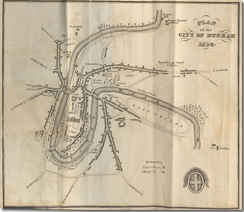
Map of Durham from 1824. Taken from Historic and Descriptive View of the City of Durham by George Allen. (DUL ref L 942.81 DUR/CIT/ALL)