
|

Why did the Market Place develop where it did?
Take a look at the image below. It shows the city of Durham in 1610. Are there any features you recognise from the photographs you looked at? Can you see the following: the Cathedral; the Castle; St Nicholas’ church?
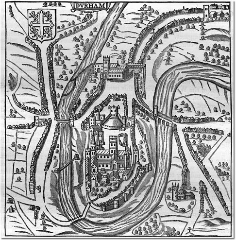
Photograph of a map of Durham City, 1610 by John Speed. (DUL ref: Gibby City/B/37). Click on image to enlarge.
What it does show is that the Market Place has been in the same place for centuries. But why did it develop here? Have another look at this map and make a list of all the reasons why this would be a good place.
Why did the Market Place develop it did?
Now have a look at this map of Durham City centre which dates from 1820 and try to find the Market Place. What do you notice about it in terms of its position? Think about what went on in the Market Place and how people would get there. Does this help explain why the Market Place developed where it did? If you need to have a closer look at the map, you can use this enlarged version.
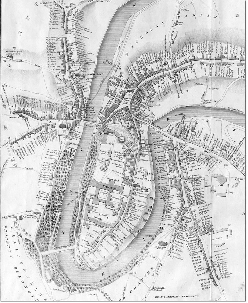
20. Map of Durham City by John Wood, 1820. (DUL ref: NSR Planfile C19/2). Click on image to enlarge.
There is another factor that might help explain why the Market Place developed in this particular place but it’s not very easy to work out from a map.
This image dates from 1809 and shows Durham City from Claypath (north-east of the centre). Can you see the Cathedral, the Castle, remains of the City walls, bridge, the river? What else can you see? Describe the position of the City centre from what you can see from this image. Does it tell us anything about why the Market Place developed where it did?
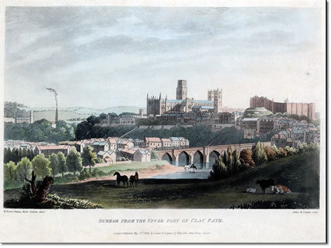
Drawing of Durham fron Claypath by William Brown, 1809.